Evidence for variable slip directions in the Landers earthquake?
These photographs were taken by Ramon Arrowsmith in collaboration with
Dallas D. Rhodes as part of our efforts to monitor the development of the
fault scarp about 1-2 km SE of the Galway Lake Road over time.
Note our paper:
Arrowsmith, J. R. and D. D. Rhodes, Original forms and initial modifications of the Galway Lake Road scarp formed along the Emerson fault during the 28 June 1992 Landers, California, earthquake,
Bulletin of the Seismological Society of America, 84, 511-527, 1994.
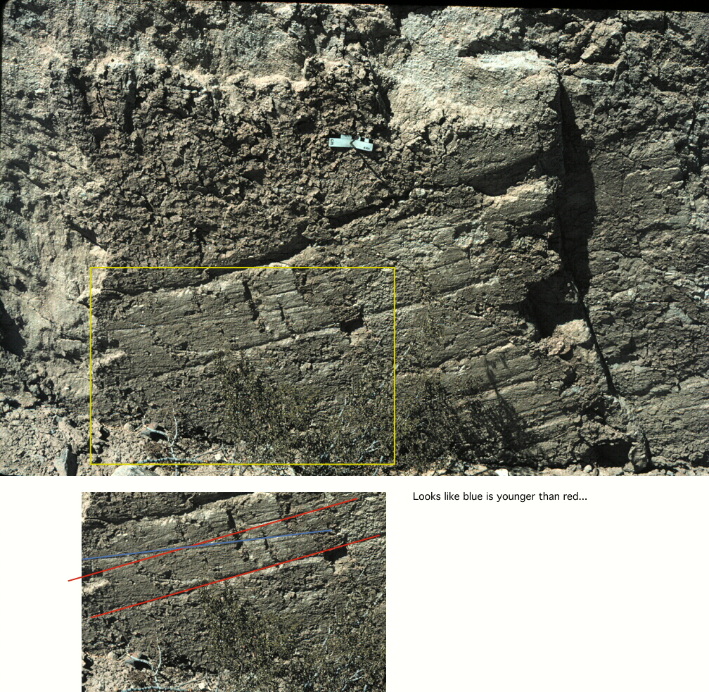
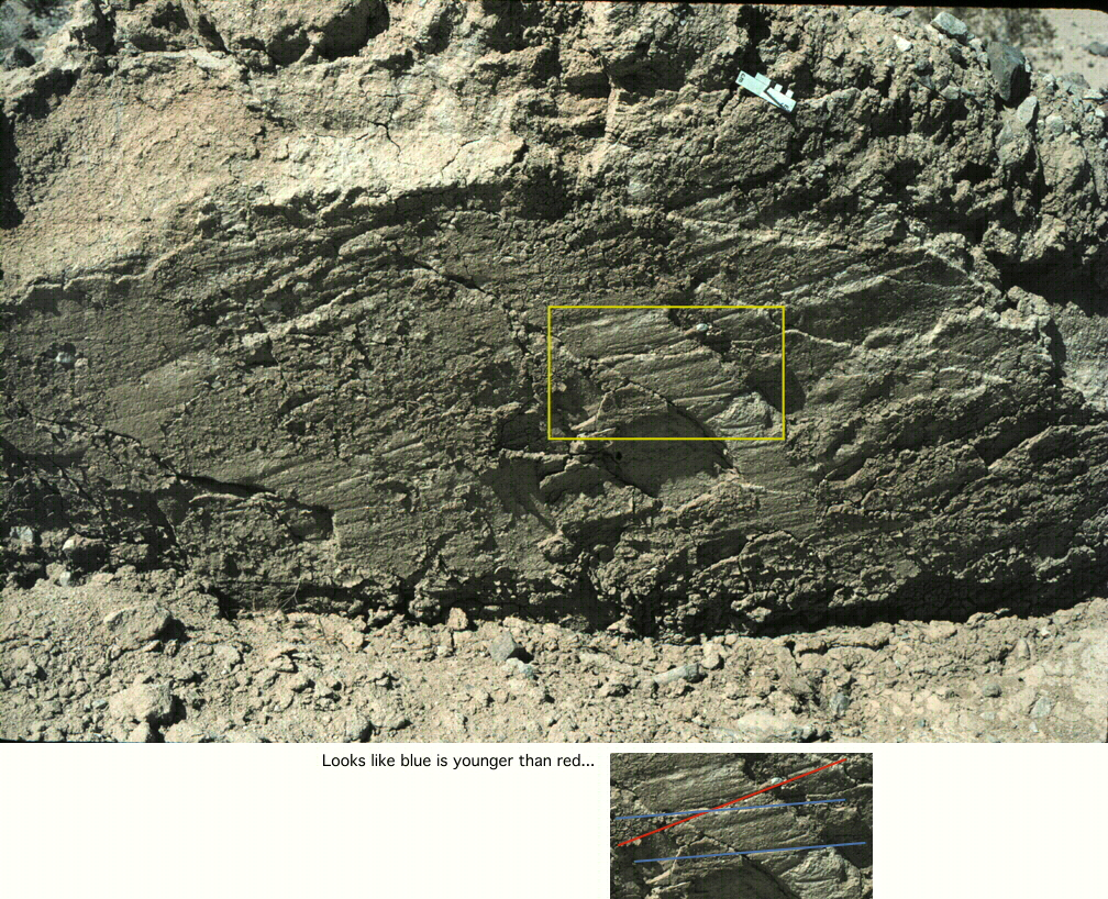
Here is a photograph of a portion of the scarp on the SE end of the area
that we studied. Most of the slip vectors are raked about 25 degrees to the
northwest:

Here is a photograph of the same site in May 1994. There has been some
erosion of the scarp and so the slickenlines have been enhanced. If you
look below at the zooms, you may agree with me that it appears that the
relatively steeper slickenlines are cut by less steeply raking
slickenlines.

Here is the same photography with some locations of closeups:

Click on us for some annotated zoom action: