|
||||||||
|
|
||||||||
|
|
Urban Environment Research Group Arizona State University |
|||||||
|
|
||||||||
|
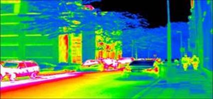
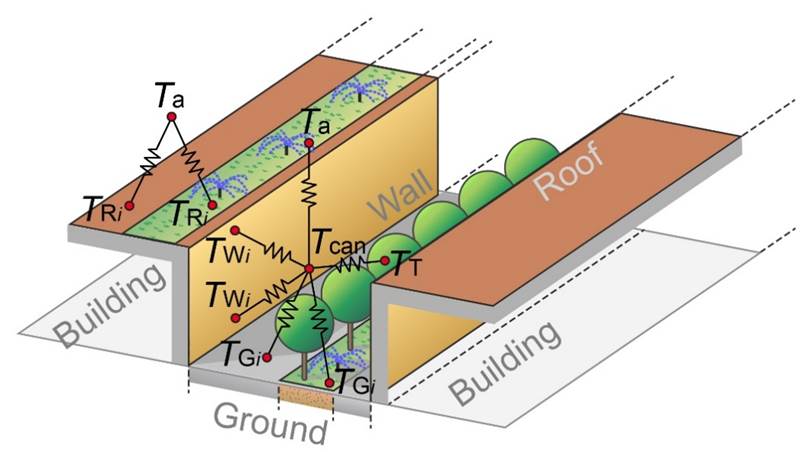
Arizona Single-Layer Urban canopy Model (ASLUM) ASLUM
is a state-of-the-art urban land surface model developed by our group since 2009. The model incorporates holistic physics of
flow and transport of energy, moisture, and scalars over built terrains. The
evolution of the first three generations of the model resolves canyon façade
heterogeneity, urban hydrology, irrigation, green roofs, and anthropogenic
heat and moisture fluxes. ASLUM (v3.x) with green roofs has been incorporated
into the Weather Research & Forecasting (WRF v3.6.1) via our
collaboration with the National Center for Atmospheric Research,
and released for public weather services in 2015. The
latest ASLUM (v4.1) (Li & Wang, 2020, see Publication) features
comprehensive parameterization of exchange of carbon dioxide (CO2)
in urban environment from biogenic, anthropogenic, and abiotic sources. |
|
|||||||
|
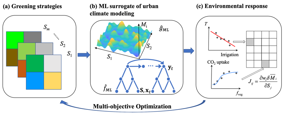
Sustainable Urban Mitigation Solutions By
urban mitigation, our research endeavor is not focused exclusively on
reducing the ambient temperature, aka urban heat island (UHI) mitigation.
Instead, we include multiple objectives measured by a compound environmental
index (CEI) tailored to specific needs of various stakeholders including, but
not limited to, UHI reduction, carbon mitigation, air quality improvement,
enhancement of energy use efficiency, and ecosystem services. Engineering
solutions for urban mitigation broadly include the use of white/grey (pavement
materials), green (urban vegetation), and blue (open water bodies)
infrastructure. We seek to optimize these solutions by combining a portfolio
of strategies using stakeholder-inspired and data-driven (e.g. machine
learning) methods. |
Quantifying compound environmental
index (CEI): (a) design of urban greening strategies,
(b) ML surrogate modeling, and (c) definition of the Jacobian matrix for
quantification of environmental response |
|||||||
|
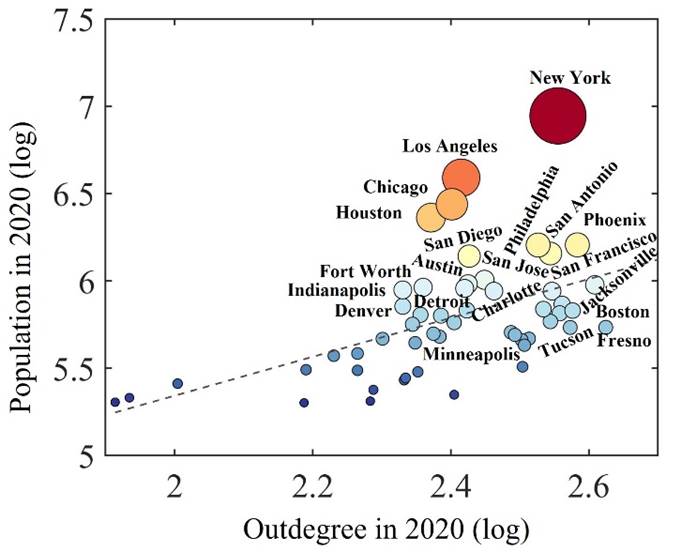
Urban Networks & Causality Cities are not isolated hotspots on Earth's surface. They are, as Jacobs pointed, 'problems in organized complexity' (The Death and Life of Great American
Cities). We probe into how various cities and/or environmental variables
(heat, pressure, humidity, wind, pollution, etc.) are intrinsically
connected, and how changes made in local cities can causally affect
spatially adjacent or even distant cities as connected networks (graphs).
Megacities, we believe, can causally mediate the evolution of future urban
climate in the face of global changes. |
|
|||||||
|
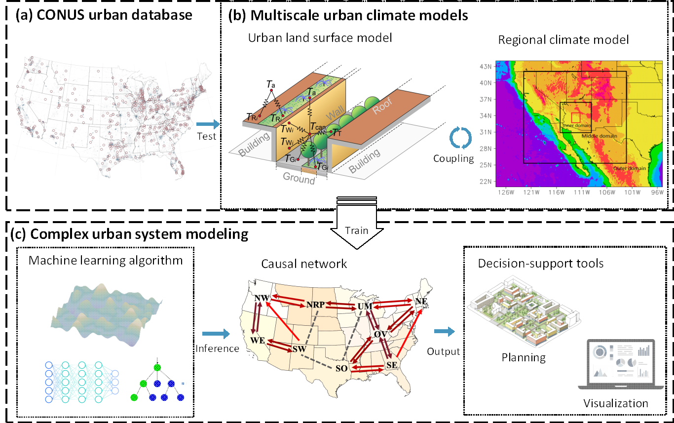
Complex Urban System Research Our decadal long research in urban dynamic guides us
to shift the paradigm of urban climate research from process-based to
data-driven-system-based framework, by treating built environments as complex
dynamic systems and invoking cutting-edge techniques of data science, network
analysis, causality, and machine learning.
Schematics for complex urban climate research: (a)
synthesis of urban database, to drive (b) multi-scale urban climate modeling,
and (c) modeling of complex urban system, using machine learning, causal
inference, and decision-support tool for urban planning and visualization. |
||||||||